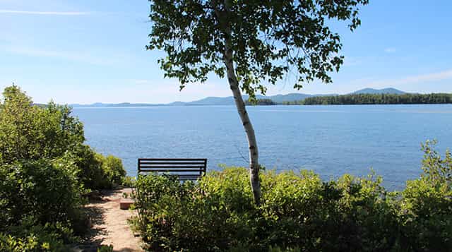
Lake Winnipesaukee, the largest lake in New Hampshire, is located in the Lakes Region of New Hampshire at the foothills of the White Mountains. Lake Winnipesaukee is the largest lake in the state at 72 square miles. Surrounded by three mountain ranges, the wooded shoreline and crystal clear water of this spring-fed lake make it a popular summer resort and a place to rest and relax in beautiful surroundings and enjoy water sports of all sorts.
Visitors may explore the numerous villages on the shores of Lake Winnipesaukee by boat or by car. Each one offers something unique. Weirs Beach has arcades and boardwalks, waterslides, a public beach, and an activity center. Meredith is a restored mill village, where you can browse through antique, art and craft galleries. Wolfeboro is a picture perfect village, right down to its historic Main Street. Center Harbor, Moultonborough, Tuftonboro, Alton, Gilford and Laconia all have their own special flavor. All communities have public parks and docks and feature varied activities such as fireworks displays and band concerts throughout the year.
The Story of Lake Winnipesaukee
Many moons ago on the northern shores of this beautiful lake there lived a great chief, Wonaton, renowned for his great courage in war and for the beauty of this fair daughter, Mineola. She had many suitors but refused them all. One day, Adiwando, the young chief of a hostile tribe to the south, hearing so much of the fair Mineola, paddled over the lake and fearlessly entered the village of his enemies. Her father happened to be away at the time and, admiring Adiwando’s courage, the rest of the Indians did not harm him. Before long, he and the Indian maid were desperately in love with each other. Wonaton, on his return, was exceedingly wroth to find the chief of the enemy in his camp and a suitor for the hand of his daughter; so much so, that he immediately raised his tomahawk and started to kill him. “Mineola, rushing in between them, pleaded with her father for the life of her lover, and finally succeeded in reconciling them. After the wedding ceremony, the whole tribe accompanied the two lovers in their canoes halfway across the lake. The sky when they started was overcast and the waters black, but just as they were about to turn and leave them, the sun came out and the waters sparkled around the canoe of Mineola and Adimwando. “This is a good omen,” said Wonaton, “and hereafter these waters shall be called Winnipesaukee, or The Smile of the Great Spirit.”
Public Boat Launches
Lake Winnipesaukee offers visitors four seasons of vacation fun! Launch your boat at one of the many launch sites on the Lake. Whatever your choice of craft, Winnipesaukee has 72 square miles to explore. If you don’t own a boat, you can rent one, charter one or take a cruise on one of the many excursion boats on the “Big Lake”. In the winter months when temperatures dip, families still enjoy the lakes. Ice fishing, skiing, snowmobiling, ice skating, cross-country skiing or ice boating provide great family recreation.
Public Beaches
Alton Town Beaches – Alton Small Swimming Beach -Restrooms, parking. No admission fee. Rt 28A on Alton Bay. No lifeguard on duty. Swim Dock on Rt 11 next to town docks. No admission fee. Lifeguard on duty.
875-0109
www.altonparksandrecreation.
Brewster Beach – Wolfeboro Rt 28, (South of downtown), to Clark Rd (across from Huggins Hospital). Beach on Lake Winnipesaukee. No fee. Restrooms, swimming, picnicking.
569-5639.
Carry Beach – Wolfeboro Public beach on Lake Winnipesaukee. Rt 28 (north of downtown) to Forest Rd. Swimming, picnicking, restrooms.
569-5639.
Ellacoya State Park – Gilford 600-ft. sandy beach on southwest shore of Lake Winnipesaukee; RV park with 38 campsites. Call (603) 271-3628 to make a reservation. Swimming, picnicking, store, bathhouse. Route 11, Gilford, 03249
(603)293-7821.
Email: nhparks@dred.nh.us
Leavitt Park – Meredith Swimming, picnicking. No fee. Small playground area. From Rt 25/Rt3 intersection in center of town, take Rt 25 North to Leavitt Rd.
279-4538
New Hampshire State Parks – New Hampshire has 45 state parks, 14 natural areas/waysides and 10 historic sites. The parks offer a diverse use from camping to swimming to just enjoying the views.
Concord PO Box 1856, Concord, 03302-1856
(603) 271-3556
Weirs Beach Endicott Park – Weirs Beach Small public beach on the Weirs Beach Channel connecting Paugus Bay with the larger portion of Lake Winnipesaukee. Historic Endicott Rock – Surveyors commissioned by Royal Governor John Endicott of the Massachusetts Bay Colony signed their initials in 1652. Great place for boat watching. Admission fee.
Rt 3, Weirs Beach – overlooking the town docks.
(603) 436-1552
19 Mile Bay Beach – Tuftonboro Swimming, picnicking. No fee. Portable toilets. No Lifeguard on Duty, parking.
Governor Wentworth Highway, Rt 109, Tuftonboro
569-4539
20 Mile Bay Beach – Tuftonboro Swimming, picnicking. No fee. No Lifeguard on Duty, limited parking.
Governor Wentworth Highway, Rt 109, Tuftonboro
569-4539
Melvin Village Warf – Melvin Village Swimming, No Lifeguard on Duty, no restrooms, limited parking. Fee charged.
Governor Wentworth Highway, Route 109, Melvin Village at the Junction of Elm Street and Union Avenue.
Fishing the Big Lake
Salmon, Rainbow Trout, Brook Trout, Lake Trout, Small/Largemouth Bass, Pickerel, Yellow/White Perch, Hornpout, Cusk, Smelt, Bluegill, Whitefish
- Best Lake Trout and Salmon fishing in New England
- Look for Salmon in Alton Bay and the Merrymeeting River when the season opens in the spring
- Troll streamer flies, lures and smelt near the surface for Salmon, Lake and Rainbow Trout in early spring
- Troll with weighted line and down-riggers in later spring
- Fish Smallmouth Bass along rocky shorelines
- Bass fishing best from May to early July (nesting period)
Lake Winnipesaukee Stats
- 504 Feet above Sea Level
- Maximum Depth: 180 feet
- Average Depth: 43 feet
- Volume: 625 billion gallons
- Length: Approximately 25 miles
- Width: Approximately 15 miles at widest point
- Water Surface: 72 square miles
- Distance around the lake: 182 miles
- Shoreline excluding islands: 178 miles
- Islands: 244
- Island shoreline: 100 1/2 miles
Lake Winnipesaukee Waterfront Towns
Meredith, Center Harbor, Moultonborough, Melvin Village, Tuftonboro, Wolfeboro, Alton, Alton Bay, Gilford, Laconia, Weirs Beach
Nature Preserves
Loon Preservation Center & Marcus Wildlife Sanctuary – Moultonborough Lees Mills Road 200-acre parcel on the northeastern shores of Winnipesaukee. Upland forests, marshes, a pond, clear running streams and more than 5,000 feet of undeveloped shore land.
Ragged Island – Tuftonboro 11-acre island maintained owned and operated by the Squam Lakes Natural Science Center. Ragged Island is not open to the public to protect the islands fragile ecosystem.
Stonedam Island – Meredith 112-acre wildlife preserve. Lakes Region Conservation Trust 603-279-3246.
The Lakes Region Conservation Trust provides public access for hiking, skiing, snowshoeing, and paddling to over 145 properties throughout the Lakes Region including some of New Hampshire’s most beautiful and beloved conserved areas such as the Castle in the Clouds Conservation Area in Moultonborough, the Piper Mountain Conservation Area in Gilford, the Sewall Woods Conservation Area in Wolfeboro, the Sugarloaf Ridge – Goose Pond Conservation Area in Alexandria, and Ragged and Stonedam Islands on Lake Winnipesaukee. You can learn about these wonderful properties and more and find trail maps at lrct.org.
Major Events
- Great Rotary Fishing Derby – Headquarters in Meredith February Sponsored by the Meredith Rotary Club.
- Sled Dog Races – Sandwich Notch 60, Laconia, Meredith
- Winni Derby going on its 25th year. Mid May, Sponsored by the Lakes Region Inland Fishing Association.
- Laconia Rally & Race Week – June
- Timberman Triathlon – Gilford
- Lakes Region Arts & Crafts Festival – Meredith Juried show
- Crafts Fairs – Alton, Wolfeboro
- NASCAR – New Hampshire Motor Speedway
- NH Open Water Ski Tournament – Back Bay Wolfeboro, Abenaki Water Ski Club USA Water Ski sanctioned.
Hiking Around Lake Winnipesaukee
Belknap Mountain – Gilford Turn of Route 11A at Gilford, drive south through Gilford Village, pass the high school, road makes a sharp left. And you will begin drive up Belknap Mountain Road to parking and trailhead. 1 1/2 miles, vertical rise 740 feet Magnificent views
Mt Major – Alton Bay. Route 11 A about five miles north of Alton Bay (close to Ellacoya State Beach) highway sign marks parking lot. Popular hiking spot due to spectacular views. 2 1/2 mile, vertical rise 100 feet.
Chamberlain-Reynolds Memorial Forest – 157 acre forest with over a mile of waterfront, several beaches, swamp walk, over 4 miles of hiking trails managed by the Squam Lakes Association- Trailhead off College Road, Center Harbor
West Rattlesnake Mountain – Rt. 113 Holderness – Trailheads off Rt. 113 – approx. 5 miles from downtown Holderness on right, (after Rockywold Deephaven Camps sign) park on left. Short and Easy Climb, spectacular views. Use caution with children. Steep cliffs at summit.
Red Hill – Moultonborough (elevation 2,029 feet) Fire tower run by town of Moultonborough Fire Department. Bean Road in Center Harbor 1.4 miles to Shibley Road (fire tower sign) to parking lot with gated jeep road. Distance to tower 1.7 miles. Contact the Lakes Region Conservation Trust for a map 603-279-3246. Ossipee Mountains, Bald Peak – Tuftonboro. Trail access from Castle in the Clouds offering a variety of difficulty levels.
Gunstock Recreation Area – Gilford. Four season recreation area on Route 11 in Gilford. It includes a major downhill ski/tubing area on Mount Rowe and Gunstock Mountain, a 420-site campground, summer mountain Sports Park (skateboard, mountain board, mountain bike and a cross-country skiing area. A map of hiking and mountain biking trails is available at the Base Lodge).
Abenaki Tower – Wolfeboro Route 109 in Tuftonboro. A 5-minute walk from the parking area to an 80’ tower overlooking Lake Winnipesaukee and the Ossipee Mountains.
Cotton Valley Trail – Wolfeboro to Sanbornville – A 12-mile railroad corridor stretching from Lake Winnipesaukee to the railroad turntable in Sanbornville. It meanders across three lakes, many trestles, Cotton Valley and winds through scenic woods and fields. Contact Wolfeboro Chamber for info 603-569-2200
Russell C. Chase Bridge Falls Path – behind the Railroad Station is a half-mile path from downtown to the Wolfeboro Falls Area.
State Parks & Beaches
Ellacoya State Park, Gilford
Cross Country Ski Trails
Wolfeboro Cross Country Ski Association WCCSA – Headquarters for trail maps, tickets and information is located at Nordic Skier, downtown Main Street. Hiking, biking, X-C ski trail networks. Gunstock Recreation Area, Hiking, biking, X-C ski trail network Gilford Ski, Snowshoe, bike, mountain board, mountain scooter rentals